[ad_1]
Lâm Giang
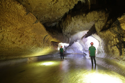
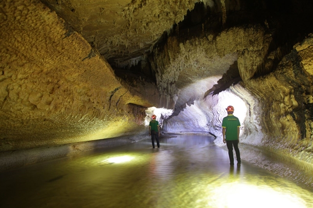
Located in the vast forest of Ba Bể District, Bắc Kạn Province, Thẳm Phầy Cave in Nà Slải Village, Hoàng Trĩ Commune beckons adventurous travellers to conquer its pristine and mysterious beauty.
Stopping on the concrete road connecting the villages, we walked to the only path along the mountainside to explore the cave.
The sudden rain made the path slippery, a bit more dangerous than usual when walking on a variety of terrain. We crossed through terraced fields, springs, bamboo bridges and thick bushes to reach the cave.
The two kilometres of weaving in the forest made us tremble due to the vast deserted space.
According to Hoàng Văn Cơ, a local in the village, Thẳm Phầy in Tày language means “fire” cave, which was discovered by locals many years ago. It is about 5-6km long.
Thẳm Phầy cave was likely formed due to volcanic eruptions and the tectonics of limestone mountains passed by underground rivers to cause erosion, combined with water droplets having the minerals of limestone dripped after millions of years, creating many beautiful stalactites and stalagmites.
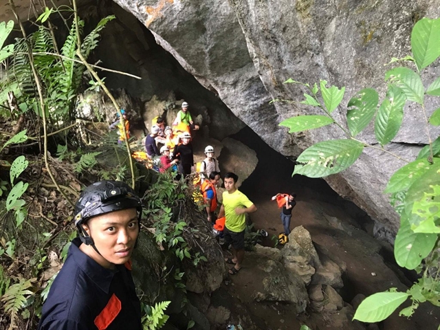
The mouth of the cave is hidden, so it is difficult to find. From the cave entrance, going down about 20m is quite slippery because the ground is below and water comes down from the cave door.
Right at the entrance to the cave are rocks shaped like the teeth of a giant dinosaur, below is an underground stream with a shallow and moderate flow. While the stream inside is quite wide, the water in some places is about 1.5m deep. In many places, the water erosion process forms yellow and white stalactites with many beautiful and mysterious shapes.
Over the cave ceiling and cave walls are beautifully shaped stalactites. The two sides of the entrance to the cave also have rocky banks with beautiful shapes. Going deep into the cave, many bats cling to the dome.
About 1km from the entrance, there are two branches of the cave, one on the left runs into the mountainside, while the other on the right reaches the heart of the mountain with the deep water level.
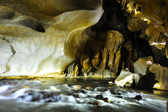
We decided to follow the left side and went from surprise to surprise. The bottom of the underground stream is mainly sand so we could see the spring bed through the clear water.
The water source in the cave is completely pure and provides water for people in the village.
Stalactites and stalagmites with vivid shapes seemed to hold our feet. Sometimes it looks like the curtains of a castle, sometimes like a silk strip lying indifferently on the cliff. There are winding stone veins as if they are taken care of by skilled craftsmen. There are many stalactites like silk threads on the cave walls.
We saw water flowing from the mountain, forming small geysers along the cliffs. They are very unique, sometimes like a small waterfall, sometimes like the mouth of a large tube.
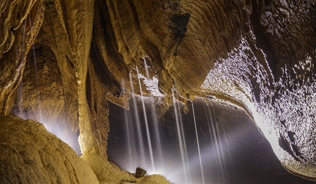
The highest area of the left cave is about 20m high. It is wide as a building with short and long stalactites. It also has many rock layers.
The deeper we got into the cave, the cooler the air became and the deeper the spring grew.
Meanwhile, people following the right branch had to dive under the water to get through the canopy, but the depth of the cave in this branch was short so they returned.
According to Cơ, during the flood season, the stream near the cave’s mouth is very dangerous and water can rise up at any time to flood the cave ceiling.
We thought that Thẳm Phầy cave was a little similar to Sơn Đoòng cave in Quảng Bình Province, the world’s largest natural cave. Thẳm Phầy also has a beautiful rocky shore forming a path in the cave. Its arch is wide and high, while below is water flowing with the presence of bats and lush vegetation.
Thẳm Phầy cave is being assessed by the local authorities to be used as a unique tourism product of Bắc Kạn Province, but the exploitation will have to ensure sustainable development. — VNS
[ad_2]
Source link
